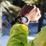
The Casio Pro Trek Smart Outdoor Watch
The Casio Pro Trek Smart Outdoor Watch WSD-F20 is a vital piece of equipment for any adventurer ready to take on the worlds challenges. The sturdy, durable watch has a whole list of functions all relevant to the intrepid explorer within us all. Suitable for almost any excursion such as hiking, snow sports, water sports, cycling and fishing this watch can handle it all giving you the freedom to try it all and make the most of your active lifestyle.
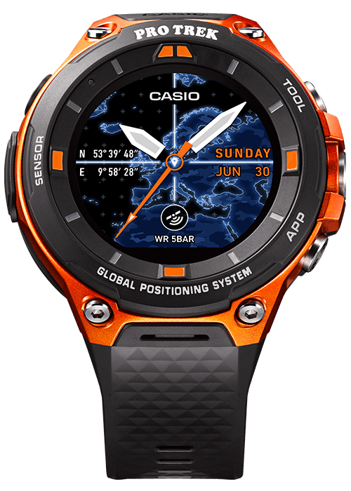
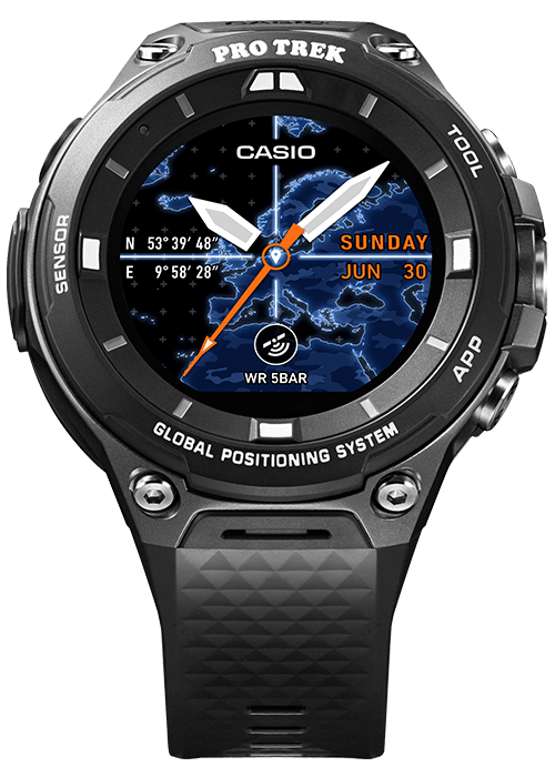
It is available in two colours the WSD-F20-RG which is orange and black and the WSD-F20-BK which is an all black model. Both of them come with an AC adaptor and a special charger cable and are set for release on April 21, 2017.
GPS +
The Casio Pro Trek Smart Outdoor Watch WSD-F20 has a GPS and a full colour map, it determines your current location using energy-efficient GPS and indicates your exact location on the full-colour offline map on the watches face.
Built in low-power GPS
The build in GPS integrates positioning data from three satellites from Japan, America and Russia (Japanese “MICHIBIKI” QZSS, American GPS and Russian GLONASS*).
After it receives positioning data it displays your current position on a full-color map as listed above.
* Compatibility to be added soon.
Full-colour map display for offline use
The Casio Pro Trek Smart Outdoor Watch supports map data downloads through partnership with Mapbox, an innovative company that design and create worldwide map data. These maps can be displayed even if your smartphone is offline for example in areas where no cellular service is available (perfect for adventures into the unknown). This map works in tandem with the built in GPS functionality. Mapbox maps are also customisable and you can download a variety of map designs before your trip and then choose the one you want depending on the type of adventure or activity you are going to be doing.
The watch also includes a function named ‘Traveler’ which enables the user to switch the information displayed in the window in the lower part of the watch face to any of the following: Date, Altimeter, Compass and Barometer.
* Download a map of your destination region in advance and select colour area maps to use offline when you arrive.

Main Specifications
| GPS | Compatible (including GLONASS*1 and Michibiki) |
|---|---|
| Color Maps | Compatible (supports offline use) |
| OS | Android Wear 2.0 |
| Display | 1.32-inch dual layer display Color TFT LCD and monochrome LCD Color: 320 × 300 pixels |
| Touchscreen | Capacitive touchscreen (anti-fouling coating) |
| Water Resistance | 50 meters*2 |
| Environmental Durability | MIL-STD-810 (United States military standard issued by the U.S. Department of Defense)*3 |
| Sensors | Pressure (air pressure, altitude) sensor, accelerometer, gyrometer, compass (magnetic) sensor |
| Microphone | |
| Vibrator | |
| Battery | Lithium-ion battery |
| Wireless Connectivity | Bluetooth® V4.1 (Low Energy) Wi-Fi (IEEE 802.11 b/g/n) |
| Buttons | TOOL button, Power button, APP button |
| Charging Method | Magnetic charging terminal |
| Recharging Time | Approx. 2 hours at room temperature |
| Battery Life | Normal use: more than 1 day, roughly (varies according to use) Timepiece Mode (timekeeping only): more than 1 month, roughly (varies according to use) |
| Size of Case | Approx. 61.7mm × 56.4mm × 15.3mm (H × W × D) |
| Weight | Approx. 92g (including watchband) |
Operating Environment
Use of the device requires a smartphone with the following specifications.
| Android™ |
|---|
|
Smartphone with Android 4.3 or later.
|
| iOS |
|---|
|
One of the following models with iOS 9 or later:
|


